With SMAUT’s modular system of hardware and software, you can unlock up to Level 4 autonomy – from GPS-guided navigation to full AI-based operation with zero human supervision. Each level reflects what your machine can actually do in the field.
Level 0 – Basic GPS-Based Autonomy
The machine follows a pre-planned route using GPS and RTK signals – with no ability to detect obstacles or react to its surroundings. Suitable for open areas with stable satellite coverage.
The machine monitors its position, detects obstacles, and operates reliably even with limited GPS signal – enabling stable, semi-autonomous mowing in structured environments.
The machine builds a 3D understanding of its surroundings, avoids both static and dynamic obstacles, and updates its route in real time – making it suitable for complex and semi-structured terrain.
Level 3 – Extended Autonomy
The machine plans its path, makes decisions, and adapts to terrain and hazards independently – operating with near-full autonomy in open environments without prior preparation.
All hardware and software is developed in-house and designed specifically for outdoor, off-road and mowing environments.
Autonomous mowing in large PV areas
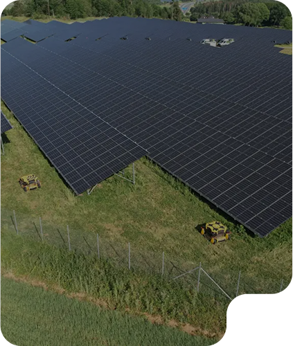
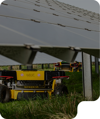
SMAUT powers machines like Spider Autonomous 2.0 in solar parks across Spain, Germany, and Austria—enhancing efficiency, reducing labor requirements, and preventing costly vegetation-related losses.
Safe operation where humans struggle
From railway embankments to airport perimeters, SMAUT enables machines to navigate and maintain steep, hard-to-reach terrain – reliably and with minimal supervision.
Smart navigation in narrow row crops
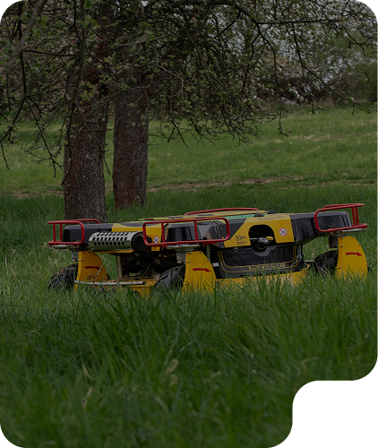
SMAUT’s modular system supports precise movement in structured agricultural layouts – helping machines perform green care operations between vines and trees.
SMAUT Levels of Autonomy in Detail
Each higher autonomy level is achieved by adding more advanced software and hardware – sensors, control logic and environmental awareness. These elements – which SMAUT calls products – are combined into a modular system that scales with your needs and machine type.
Up to 30 % more efficient mowing
Up to 38 % lower operator costs
Level 0 – Basic GPS-Based Autonomy
At this foundational level, the machine operates by following a pre-planned route using GPS and RTK signals, with no capacity to adapt or react to unexpected events or changes in its environment. The system executes instructions with precision but lacks real-time awareness or decision-making, which makes it entirely dependent on initial programming and a stable satellite signal.
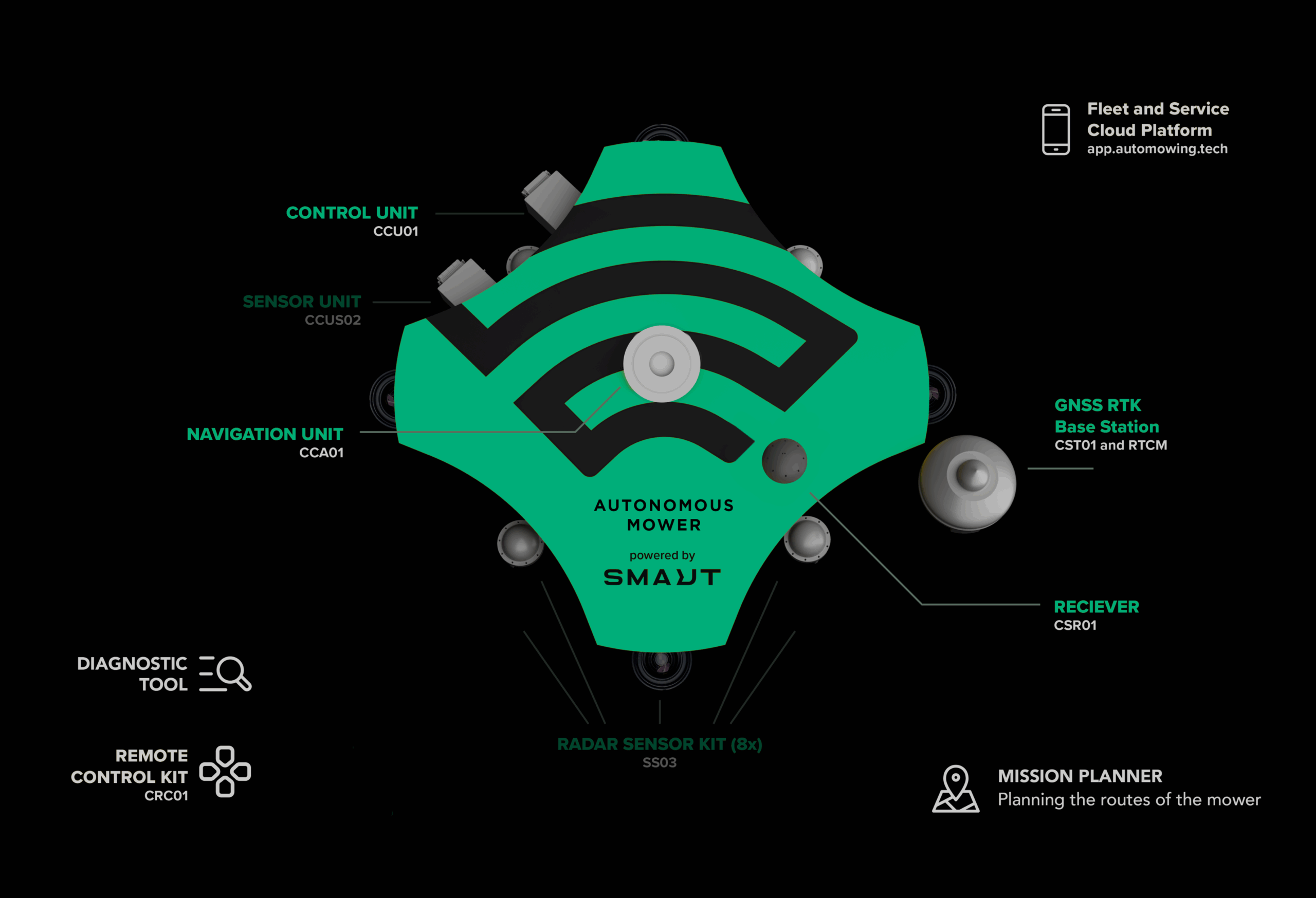
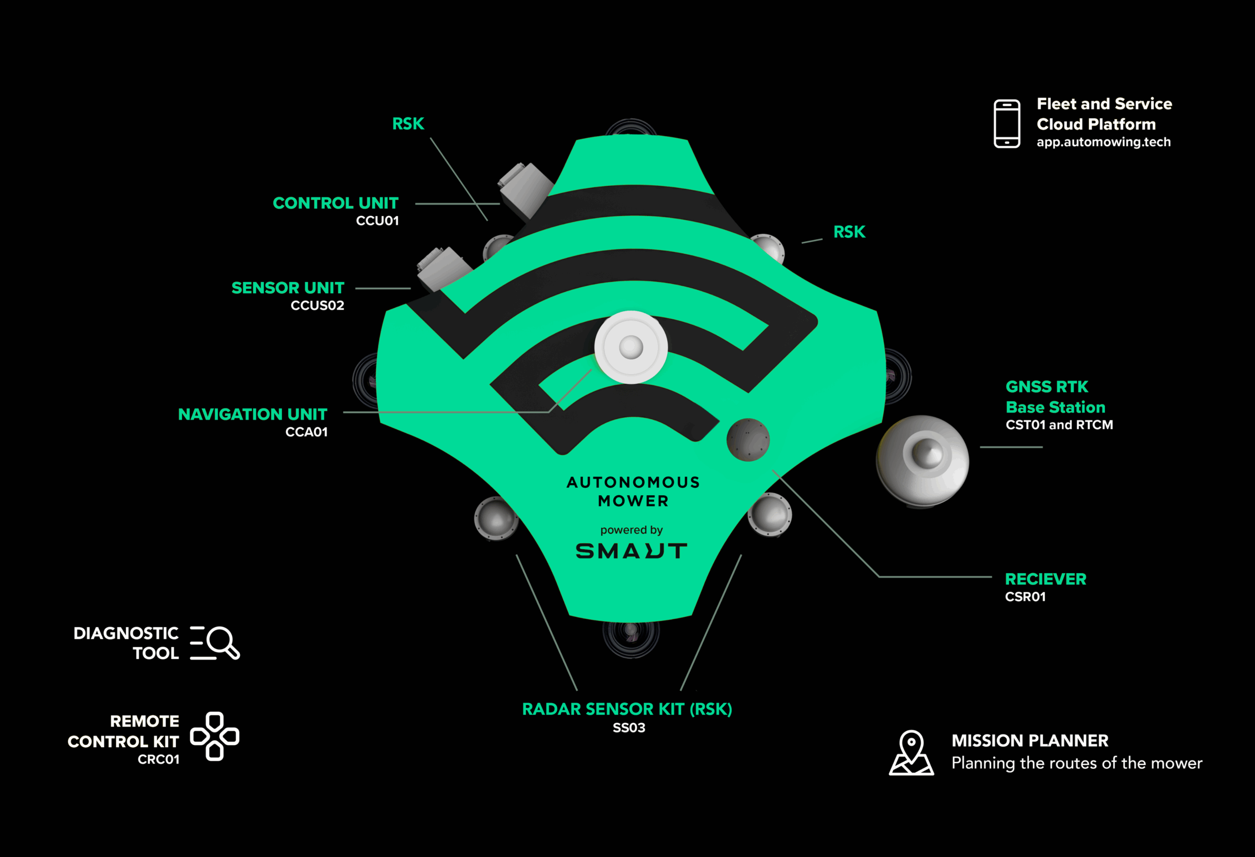
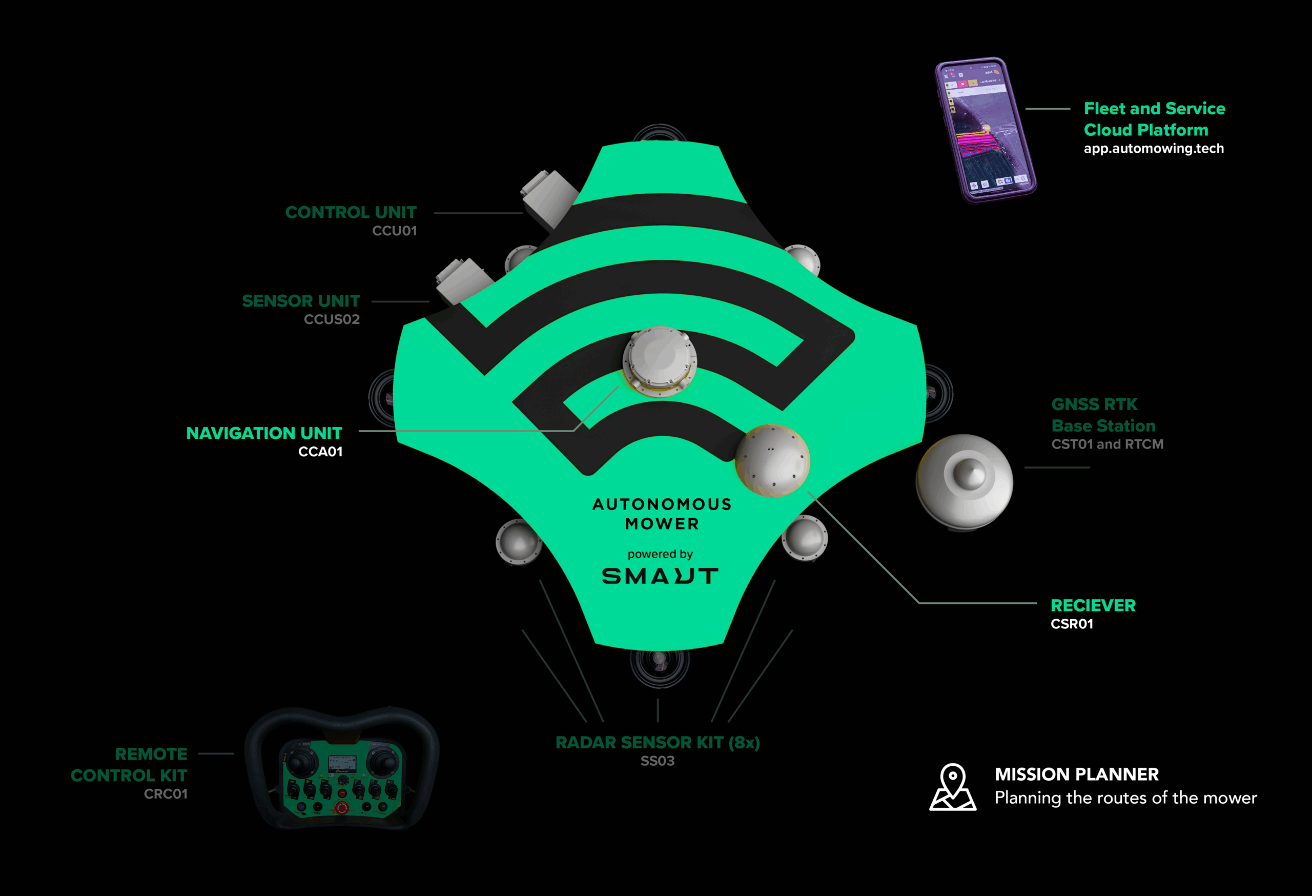
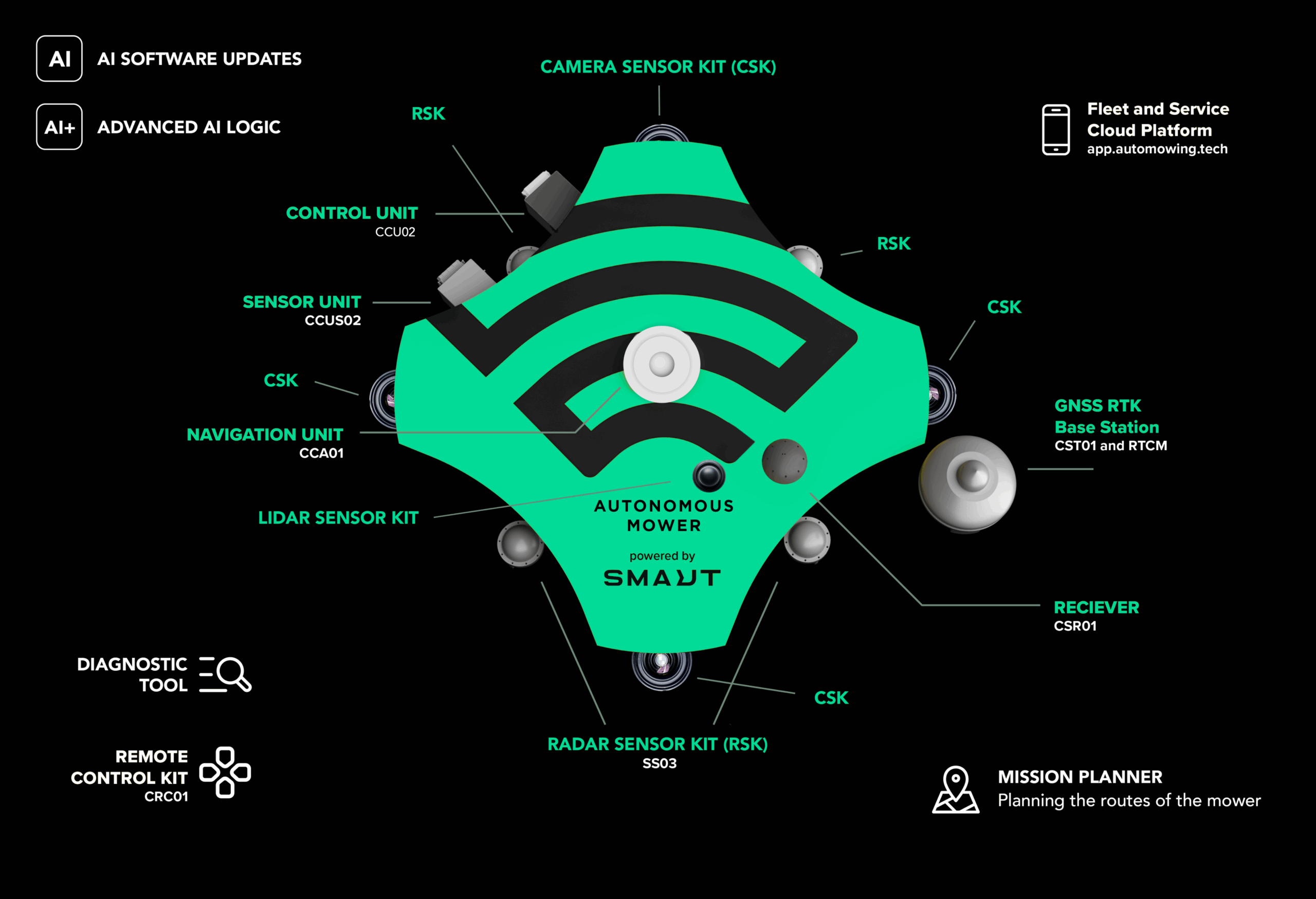
Hardware: Control Unit, GNSS RTK, Navigation Unit, Receiver, Porta
Navigation Unit, Receiver, Portal
Functionality: Follows pre-planned GPS routes, no adaptation to environment
Notes: Requires GPS coverage; no autonomy beyond route playback
At this level, the machine is equipped with advanced localization and obstacle detection technologies. These enable precise movement tracking, obstacle recognition, and the use of a multi-layer map. As a result, the machine operates more reliably even in areas with limited satellite navigation, gaining basic environmental awareness and fleet-level connectivity for monitoring and control.
Hardware: Control Unit, GNSS RTK, Navigation Unit, Receiver, Portal, Sensor Unit, Radar Unit
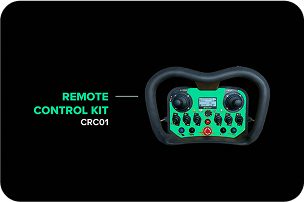
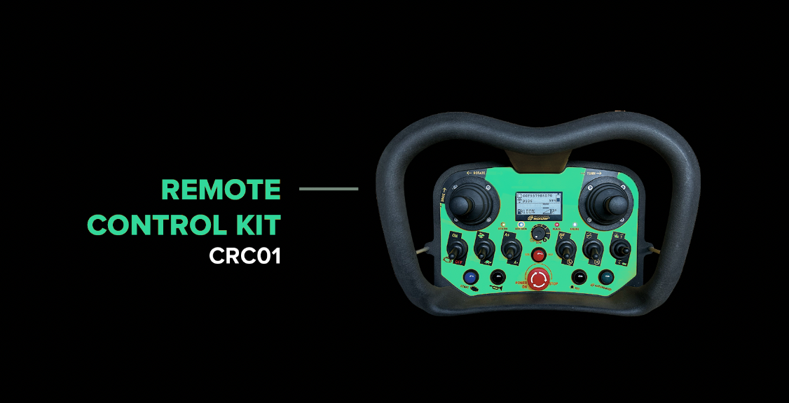
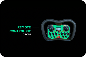
Optional: Remote Control Kit
Functionality: Basic awareness of surroundings; connectivity for fleet-level control and monitoring; more stable operation even with limited GPS
Notes: Requires upgraded software and additional sensors; designed for more robust performance in partially obstructed environments
At this level, the machine incorporates foundational mapping and advanced multi-sensor fusion, enabling it to interpret its surroundings with greater accuracy and optimize route planning. It can dynamically update navigation paths, detect both static and dynamic obstacles, and begin to make partial autonomous decisions for safer and more efficient operation in semi-structured environments.
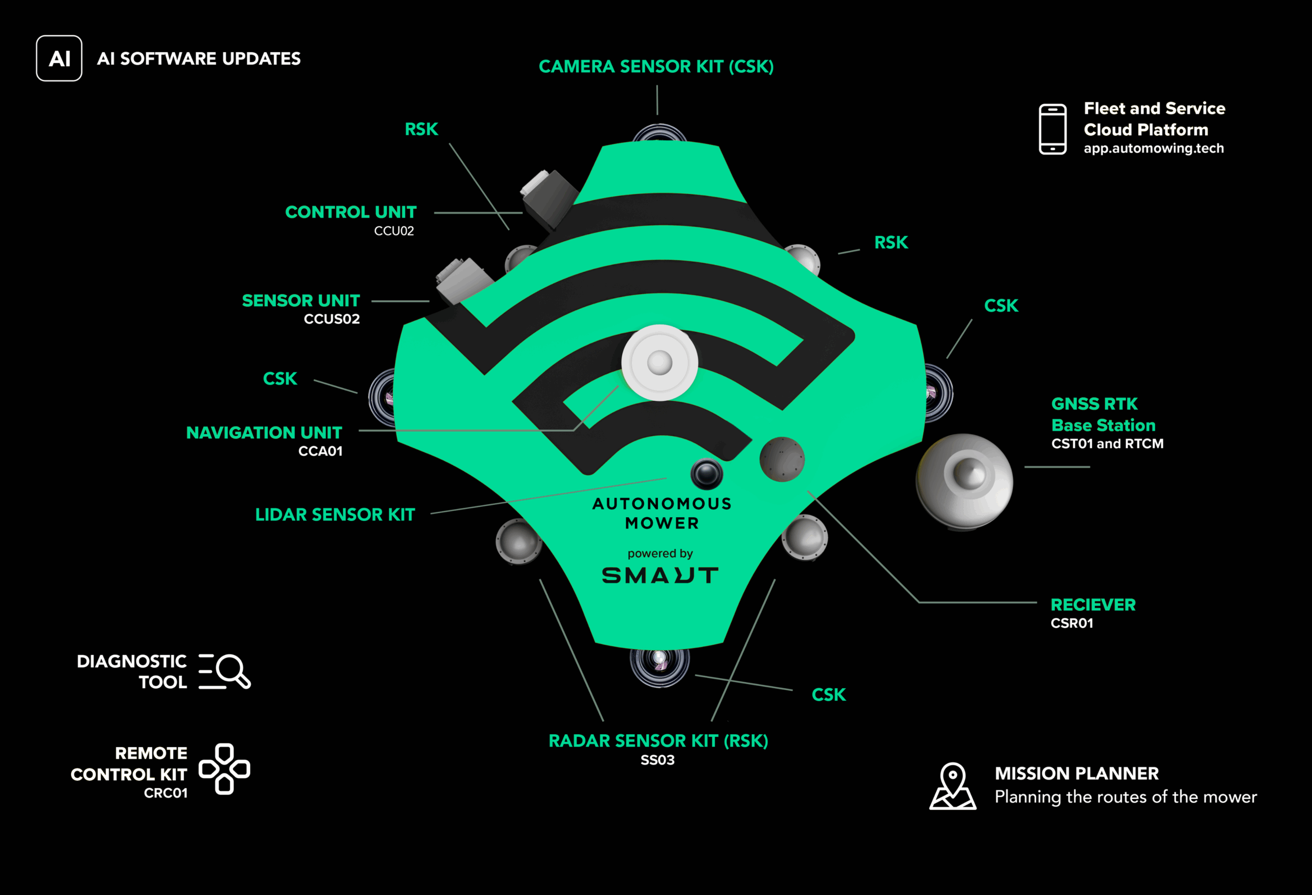
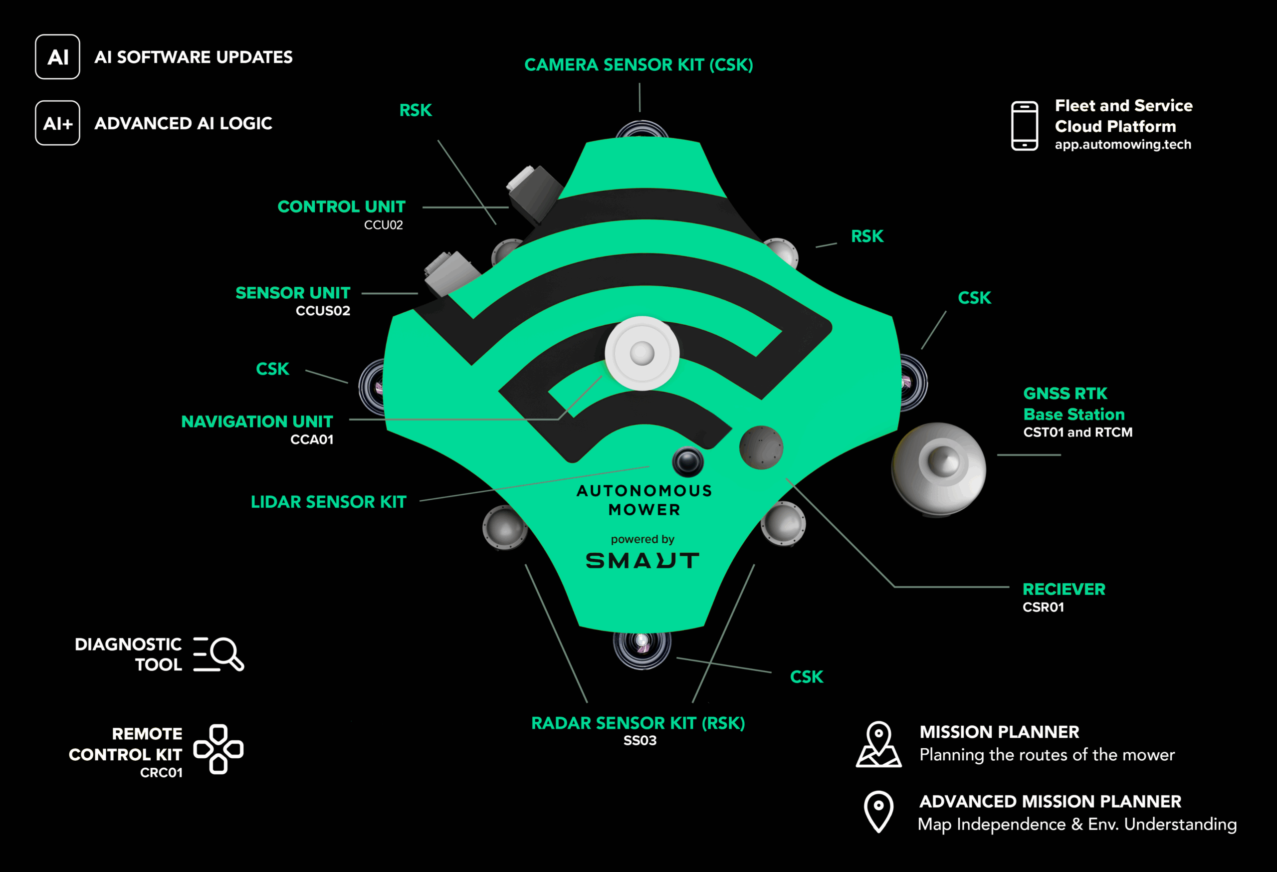
Hardware: Control Unit, GNSS RTK, Navigation Unit, Receiver, Portal, Sensor Unit, Radar Unit, Lidar Radar Kit, Camera Sensor Kit
Optional: Remote Control Kit
Functionality: Real-time 3D perception of environment; detects and avoids static and dynamic obstacles; enables safe navigation in semi-structured environments
Notes: Requires lidar, camera sensors, and AI software upgrades; introduces partial autonomous decision-making
Up to 70 % more efficient mowing
Up to 65 % lower operator costs
Level 3 – Extended Autonomy
At this level, machines achieve near full autonomy and operate independently, adjusting to terrain and obstacles in open environments without prior preparation. With advanced sensors, AI-driven algorithms, and real-time data processing, the system can navigate complex landscapes, avoid hazards, and complete tasks efficiently without human intervention.
Hardware: Control Unit, GNSS RTK, Navigation Unit, Receiver, Portal, Sensor Unit, Radar Unit, Lidar Radar Kit, Camera Sensor Kit
Optional: Remote Control Kit Adds: Advanced AI-driven software logic
Functionality: Autonomous path planning, decision-making, and recovery
Notes: Enables high-level autonomy and efficient operation in complex, unstructured environments

Up to 85 % more efficient mowing
Up to 90 % lower operator costs
Level 4 – Full Autonomy in Unmapped Areas
At this highest level, machines operate with complete autonomy, navigating without pre-made maps and orienting themselves in entirely unfamiliar terrain. With advanced environmental understanding and decision intelligence, they can identify objects, adapt in real time to changing conditions, and perform safely and efficiently in open or public spaces — without any human supervision.
Hardware: Control Unit, GNSS RTK, Navigation Unit, Receiver, Portal, Sensor Unit, Radar Unit, Lidar Radar Kit, Camera Sensor Kit
Optional: Remote Control Kit
Functionality: Navigates and maps new environments in real time; no fences or predefined maps required; designed for open spaces and public areas; zero human supervision needed
Notes: Represents full autonomy; machines can start operation immediately without prior preparation
Level 0 – Basic GPS-Based Autonomy
At this foundational level, the machine operates by following a pre-planned route using GPS and RTK signals, with no capacity to adapt or react to unexpected events or changes in its environment. The system executes instructions with precision but lacks real-time awareness or decision-making, which makes it entirely dependent on initial programming and a stable satellite signal.
Hardware: Control Unit, GNSS RTK, Navigation Unit, Receiver, Porta
Navigation Unit, Receiver, Portal
Functionality: Follows pre-planned GPS routes, no adaptation to environment
Notes: Requires GPS coverage; no autonomy beyond route playback
SMAUT delivers autonomy through a modular system of hardware and software components. These products are combined to achieve the desired autonomy level (Level 0–4), specifically tailored to the demands of mowing and green care machinery operating in real-world terrain.
Amos Scalable Operative System:
AMOS (Autonomous Machine Operating System) is a scalable, modular software platform that forms the core control system of autonomous machines. It connects sensors, navigation, motion control, system monitoring, and user interfaces into a single, unified ecosystem through a standardized communication architecture. Designed for scalability, reliability, and autonomous operation, AMOS enables efficient machine control, real‑time monitoring, and seamless integration of advanced technologies across complex environments such as agriculture, infrastructure, and industrial applications
Enables real-time detection and classification of obstacles. Essential for Level 1+ autonomy in dynamic environments.
Camera Sensor Kit:
Supports 3D scene understanding and object recognition. Required for AI-based navigation (Level 2 and up).
LIDAR Sensor Kit:
Provides high-resolution 3D environmental mapping and object detection. Enhances spatial awareness and is essential for advanced autonomy and real-time navigation.
Fleet and Service Cloud Platform:
Accessed via portal app.automowing.tech. Enables fleet management, data logging, software updates, and diagnostics. Required for Levels 0–4. Integrates with control unit and sensor suite for remote supervision
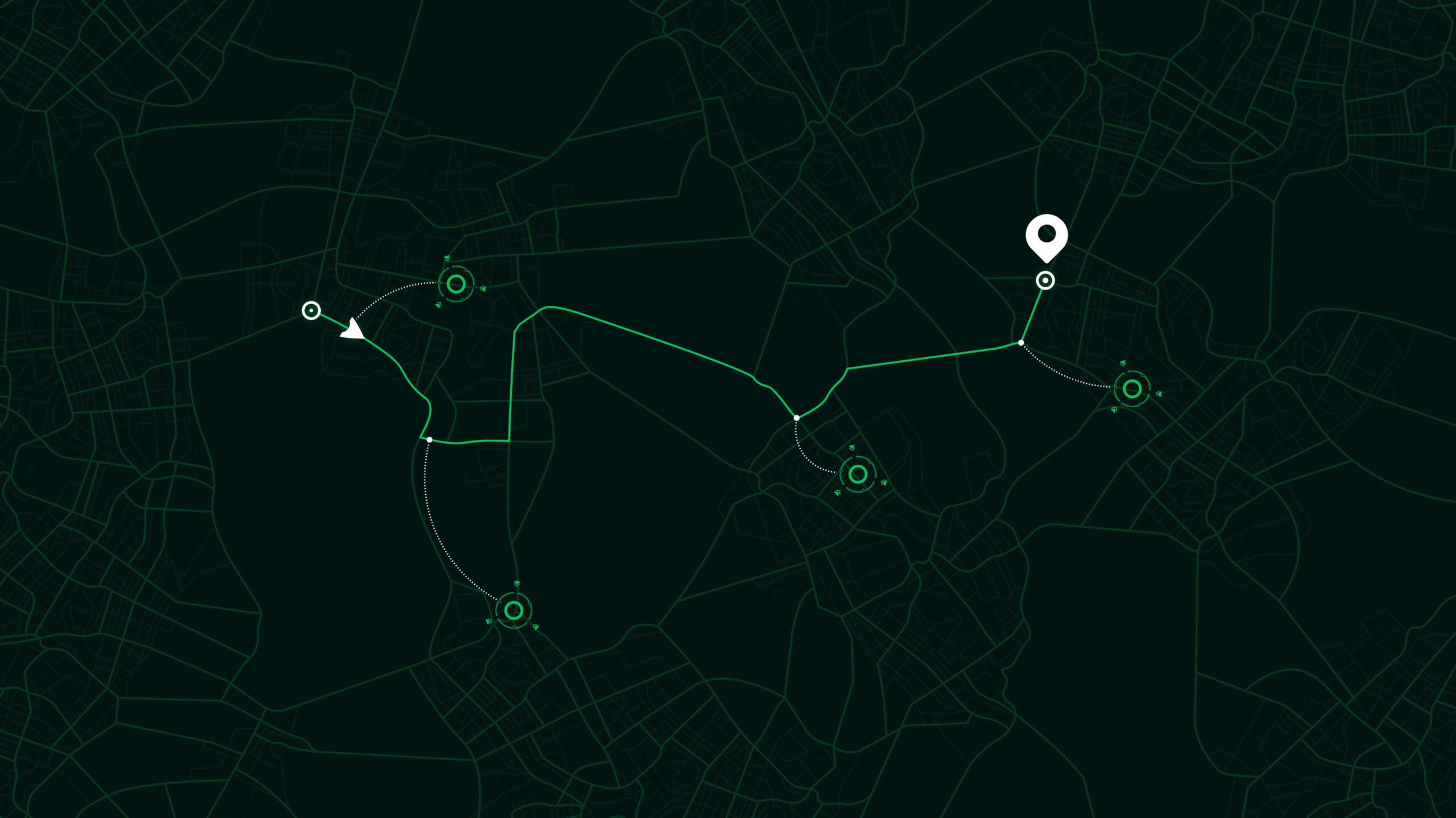
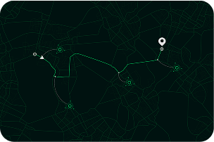
Intuitive web-based tool for creating, editing, and managing mowing routes. Enables users to define work zones, set boundaries, and assign tasks – with full integration into the control unit and cloud platform for remote deployment and monitoring.
It is designed for configuration, monitoring, calibration, and data logging of SMAUT autonomous systems. The tool offers real-time diagnostics, firmware updates, management, route handling, and deep insight into machine behavior, sensors, and control algorithms.